Through our family research we found that three of our lines were particularly associated with farming the Gwent Levels, the Watkins family of Pye Corner, the Phillips family of Nash, and the Phillips family of Wentloog. Being born and raised in Newport we knew people from the area but didn’t know much about the Levels except for the reens and flat landscape. So, this seemed like a perfect opportunity to find out a bit more.
The Gwent Levels formed after rising sea levels created the Severn Estuary around 8000 years ago. Along the low-lying edge of the estuary formed a vast watery wilderness of tidal mud flats, creeks, saltmarshes, peat bogs, reed swamps and wet woodland. Roman engineers were first to reclaim the land from the sea through a network of banks, ditches, drains and sluices to control water levels.
After the Romans left in the 5th century, drainage failed, and the Levels returned to a wetland. 600 years later the Normans attempted to tame the Levels again. Monks repaired and extended the Roman sea-defences and ditches, forming the pattern of reens, small fields and winding lanes that can still be seen when you drive through the Levels.
Following the dissolution of the monasteries, King Henry VIII introduced laws to govern the management of coastal wetlands. He created Commissioners and Courts of Sewers to oversee the maintenance of seawalls and drainage ditches, a system that operated for 400 years.
Reen, the Gwent Level
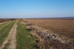
The sea wall at Peterstone
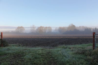
Much of this drainage system dated back to the Roman and medieval periods and helped to keep the water off the land. Sea walls along the coastline stop seawater getting onto the land, allowing it to be used for grazing and growing crops. The sea walls were often used for travelling along and today many are public footpaths and busy with dog walkers and runners.
The Levels represent the largest and most significant example in Wales of a ‘hand-crafted’ landscape, that is entirely the work of man.
The Levels now cover a substantial area with the Gwent Levels being used as collective term for both the Caldicot and Wentloog Levels on either side of the River Usk estuary near Newport. The Levels provide rich, fertile soils that give rise to high quality pasture.
Some farmlands, particularly on higher ground towards the coast are arable and used for growing crops, such as wheat, used in bread-making. The Levels are intensively farmed, but retain many ancient features, such as traditional field patterns, and unique wetland habitats.
Map of the Gwent Levels
Reen, Gwent Levels
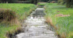
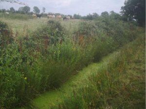
Over hundreds of years, a language that describes the different parts of the field and water systems on the Gwent Levels has developed. Many of these names are still used today, one of the more common being ‘Reen’. This refers to water ditches that people have dug and that run along the edges of fields.
A ‘Pill is a tidal creek, an area of mud or a wide ditch that has water flowing down through it from a stream or river and is filled by seawater at high tide. Whilst a Nogger is a wooden peg that is removed from a wooden plank blocking a waterway to water or irrigate fields.
The Gwent Levels have regularly cropped up in the news over the last decade due to the Welsh Government plan to bisect them with a motorway bypass aimed at eliminating traffic issues on the M4 in Newport.
The plans would have led a new 14-mile stretch of motorway through the low-lying Levels. The result would have been a loss of rare biodiversity that inhabits the drainage ditches, as well of centuries of farming tradition. The plans did not gain approval and don’t look likely to resurface.